Myrna James Yoo Publisher and Managing Editor Apogeo Spatial and LBx Journal Owner Blueline Publishing LLC Myrna@ApogeoSpatial.com
Dear Reader,
The value of geospatial tools and data continues to grow, and now, accessing that data is easier and is possible in more ways than ever before. Our ongoing series on “Filling the Gap…” (left by Google Earth Enterprise), is evolving to be about all kinds of geospatial software, digital mapping, and solutions, offered by all kinds of companies. What most of them have in common is that they are creating data platforms. These platforms are making each company’s data, as well as other companies’ data (sometimes including their competitors’ data) more easily accessible by all users, experts and non-experts alike. This is what these companies have been working towards for several years.
The more we research and cover companies in this space, the more we realize that perhaps there is no gap. Or perhaps that gap is being lled quite quickly and expertly by innovative companies that are seeing the opportunity, which is what Esri did with ArcGIS Earth (which we covered in the Fall 2015 issue).
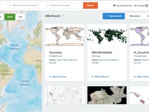
In the Spring issue, we published a teaser about what DigitalGlobe is up to, and in this issue, beginning in the article here, we go further in depth, sharing information about their GBDX (Geospatial Big Data Platform), Maps API, and other offerings. So much more than an imagery company, DigitalGlobe is providing solutions that incorporate many data sources within GBDX, and their new offering, AnswerFactory, calculates answers to geospatial questions primarily for business users. The company has different levels of users, including Developers (APIs and SDKs), GIS Users and Remote Sensing Experts (the traditional users of their imagery), and, increasingly, Business Users (for Web, mobile and desktop applications and for AnswerFactory, as well as for full information products and analytics reports).
Included is AGI’s Cesium, which began in 2012 to take time-dynamic aerospace models and put them on the Web without a plugin. AGI decided to open source Cesium, and adoption has been viral in many industries. Cesium is an SDK with which users can build implementations.
Mapbox is unique. Mapbox is included in this series because you need to know about them and their work. They are competing with Google Maps and Esri and many others, making mapping easy for non-experts, and they are stirring up some controversy. They use both OpenStreetMap (free open source data) and DigitalGlobe (not free data) for foundation data, and their clients build on that. They launched Mapbox Drive in early June, which ambitiously competes with TomTom and HERE for navigation and routing.
I think that most of us in this field believe that geospatial tools are truly doing some good in the world, but rarely do we have examples as poignant as the story from DigitalGlobe and The Associated Press in this issue, here. The story started when the AP approached DigitalGlobe for an ongoing investigation about getting images of ships deep in the ocean to prove that they were doing illegal shing. The AP was able to con rm with the image taken of the boats in the sea south of Papua New Guinea not only illegal shing, but also that many people were forced to live on these illegal boats for years at a time. The result of the “smoking gun” image, which proved the illegal activity, was prosecution, and the freedom of about 2000 slaves.
Another inspiring story is about Resilient Cities, which are committing to managing their Urban Tree Canopy for managing carbon. It features Boulder, Colorado, and mentions what is being done in New York City, Pittsburgh, and Washington, D.C. The story begins here.