Apogeo Spatial communicates the power of geospatial tools and technologies in managing the world’s environment and scarce resources, so that the global population has the security of water, food and energy.
APOGEO SPATIAL PROVIDES VISUAL INTELLIGENCE elevating global awareness for the long-term sustainability of the planet and people. Business, government and academic professionals find here the information—and inspiration—for using geospatial tools to build a more sustainable world. With the fresh, relevant insights from expert contributors, stunning visuals and clear examples of the technologies, those who make critical business and policy decisions about the world’s resources will understand the visual power of remotely sensed data.
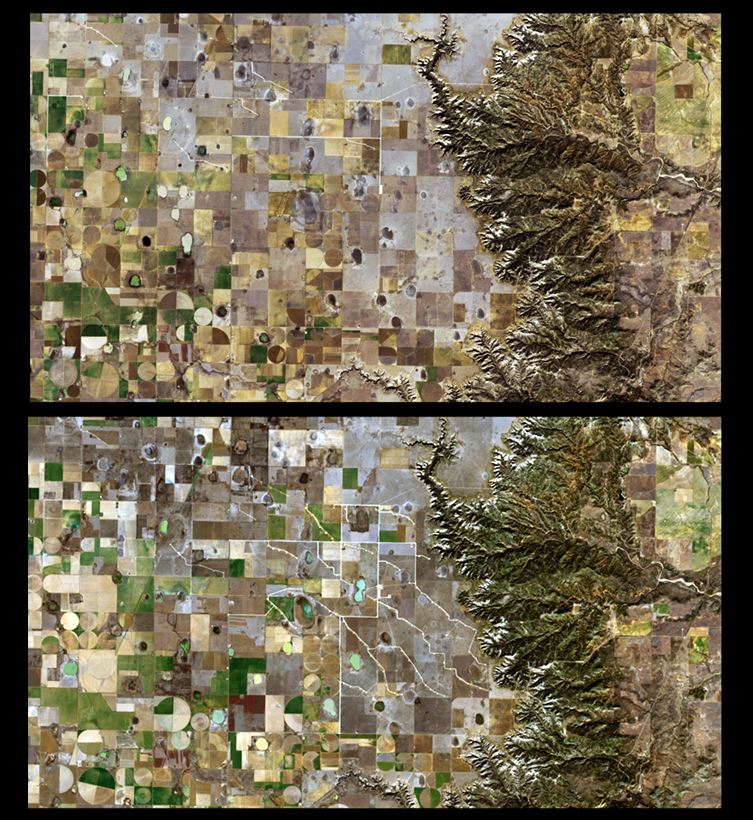
Wind Power in Texas
These two images of the Texas Panhandle of the U.S., known for fossil fuel production, show a rapid surge in wind energy development. This is the Longhorn North Wind Project, which was initiated in late 2013 and is expected to be fully operational in 2015. The top image was taken Dec. 26, 2013, and the bottom on Dec. 29, 2014. When completed, the installation will provide approximately 200 megawatts of power from 100 wind turbines. The area covers almost 57 square kilometers (22 square miles), and is only one of many new wind farms that are being developed in this region of Texas. The irregular white lines in the bottom image are access roadways that support construction of the new wind turbines and connection to major transmission networks in the area. The small bright areas on those roadways show individual turbine locations. In the bottom image is an increased number of green fields and small lakes. In September 2014, heavy rain from a tropical storm poured into this part of Texas, which had been in a drought since 2011. Images taken by Landsat 8, and courtesy of USGS.