Apogeo Spatial has entered into a Strategic Partnership with Geospatial World, with relevant articles appearing in both publications.
Apogeo Spatial has been sharing vital Earth Science data and information for 35 years, originally as a newsletter called EO Sat Notes (Earth Observation Notes), then in the 2000’s as Imaging Notes magazine, when Blueline Publishing acquired it from then-Space Imaging. In 2013, the brand of Apogeo Spatial was created from this powerful legacy of sharing why governments, academia and enterprises would use remotely sensed data. For almost 20 years, we curated and created amazing content with stunning graphics, online and in print, until 2020.
The Apogeo Spatial mission is to communicate the power of geospatial tools and technologies in managing the world’s scarce resources and environment, so that humanity has the security of water, food, energy, safety and sovereignty.
- September 1, 2013
Uncontrolled Experiment or Planetary Accident?
Read moreAt the american geophysical union (agu) science policy conference held on June 24-26, 2013, in no better place than Washington, D.C., the acknowledged center of power of our global civilization, several participants pointed out that we are conducting an…
0 - September 1, 2013
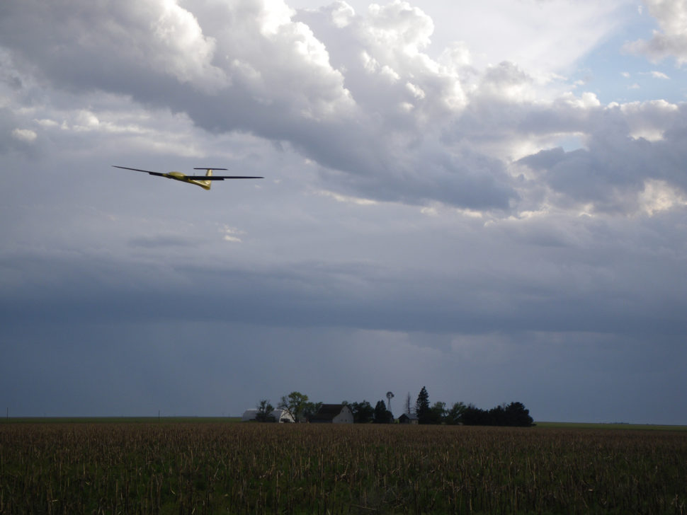
UAS for Good
Read moreUnmanned aerial systems (UAS) suffer from a public image problem these days. Between reports of U.S. drone attacks killing Pakistani civilians1 and the FBI spying on U.S. citizens with drones,2 it is easy to overlook the vast array of…
- September 1, 2013
The Age of Disruption
Read moreDEAR READERS,
What an incredible time we live in! The multiplication of technology disruptions that are taking place in the geospatial industry is quite remarkable. As a dynamic technology niche that combines hardware, software and sensors, there is rarely a…
- September 1, 2013
Elevating Information
Read moreBeginning in 2014, Astrium Services’ WorldDEM will provide a global Digital Elevation Model of unprecedented quality, accuracy, and coverage. A multitude of applications such as satellite image orthorectification, thematic mapping, aviation as well as defense and security-related missions will...
- September 1, 2013
Changing the Economics of Space for Satellites
Read moreImmediately after the Indian Ocean tsunami struck in December 2004, emergency response officials worldwide knew a disaster of unprecedented magnitude had occurred,