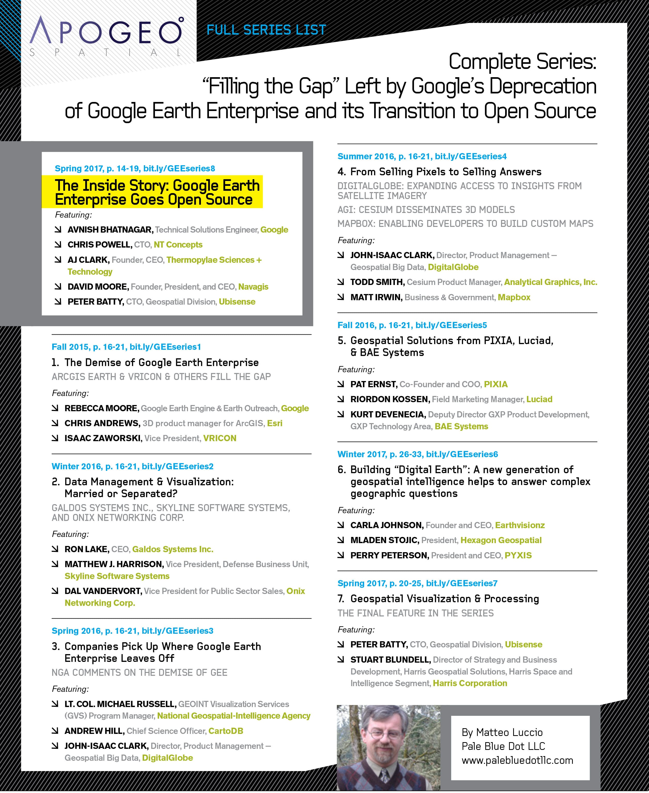
From Fall 2015 through Spring 2017, Apogeo Spatial published in eight consecutive issues our “Filling the Gap” series, in light of the news at the time that Google was deprecating Google Earth Enterprise (GEE). We knew that this news would not be welcome by the companies that had chosen GEE as their platform for 10 years. In order to serve readers, we continued covering this subject in our Geospatial Analytics-as-a-Service & Platforms Series (Fall 2017 to Summer 2018). In total, we featured 28 companies from 2015 to 2018. (link: https://apogeospatial.com/in-a-series-filling-the-gap/ )
That timeframe is when Esri launched ArcGIS Earth, now part of the Esri Geospatial Cloud. ArcGIS Earth allows you to explore any part of the world working with a variety of 3D and 2D map data formats, including KML. The ArcGIS Imagery Platform contains the Living Atlas of the World, imagery partner data, ArcGIS Pro (extensive tools for imagery management), ArcGIS Image Server for scaling imagery and more. Long-time Esri Imagery Product Manager Peter Becker promised at the Esri Imagery Summit in July 2019 that Imagery-as-a-Service is coming soon.
During the three years of our series, Google changed their approach, and decided to turn GEE over to the open source community, as we reported in our exclusive interview with Avnish Bhatnagar, which concluded our series, “The Inside Story: Google Earth Enterprise Goes Open Source.” (link: https://apogeospatial.com/the-inside-story-google-earth-enterprise-goes-open-source/ )
In the interest of providing readers with more resources, following is a non-comprehensive list of some excellent choices for geospatial platforms. Most of these platforms provide a free tier, with restrictions based on the amount of data used, time, or advanced functionalities.
Government
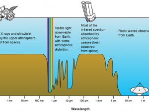
Copernicus Open Access Hub – ESA Sentinel Data By the European Space Agency, Open Access Hub is the official location to access all Sentinel Data. Easy filter, AWS locations, and downloads are available. Additionally, ESA provides an open API to access Sentinel imagery.
Earth Explorer – USGS Landsat & ISERV Imagery By USGS, Earth Explorer is the official location to access all USGS data, including Landsat and ISERV imagery. Many products and other imagery sources are accessible to download as well.
EOSDIS Worldview – NASA MODIS Data Viz By NASA, Worldview gives access and visualization to a number of imagery products, including MODIS imagery. Visualization only is available. MODIS imagery is downloadable through LAADS DAAC.
Commercial
Descartes – All Free Data By Descartes Labs, the platform includes access to Sentinel 1, 2, 3, Landsat 4-8, and MODIS. Descartes provides viewing, monitoring, and analyzing features of imagery. (link: https://apogeospatial.com/companies-offer- apis/)
EOS Landviewer – Commercial Imagery By Earth Observing System, Landviewer combines with EOS’s other high powered analysis. Landviewer provides search and visualization options, including contrast adjustment and download. Landviewer also offers easy purchase of commercial high resolution imagery. (link: https://apogeospatial.com/geospatial-analytics-as-a- service-platforms/)
GDBX – Maxar Data By DigitalGlobe/MAXAR and Other Data, the GDBX provides resources to interact with imagery using Jupyter Notebooks. With minimal coding abilities, users are able to interact with imagery and run complex analyses at scale. (links: https://apogeospatial.com/from-selling-pixels-to- selling-answers/)
Google Earth Engine – Free and Commercial Data By Google, GEE is designed for high-level processing and analysis of imagery. GEE leverages Landsat, Sentinel 2, MODIS, and other datasets along with the Google Cloud infrastructure to run analyses at scale. Earth Engine currently has restricted access.
Landsat Explorer (ESRI) – Landsat Data By Esri, Landsat Explorer is designed to easily access and visualize Landsat data. Similar products may be provided by Esri. Landsat Explorer integrates well with other Esri products. You can visualize in any arrangement of bands and perform a change detection. Some downloading is available.
Planet Apps – Planet and Free Data By Planet, apps include Planet Explorer which gives search access to commercial imagery from Planet in addition to exploring Sentinel 2 and Landsat 8. Planet Stories allows for the creation of comparison sliders and time-series GIFs published online. (link: http:// apogeospatial.com/planet-lab/)
Open Source
QGIS – Open Data to Download
An open source software, QGIS is a powerful alternative to commercial and paid GIS and Remote Sensing software. Although there is no online version (and thus all imagery will have to be downloaded), QGIS has most imagery analysis capabilities and a growing body of tutorials.
Raster Foundry – Code Available on GitHub By Azavea, Raster Foundry was the open source software that the platform upon which Radiant Earth platform was based. Raster Foundry allows easy integration with various imagery sources, custom raster algebra analyses, and easy sharing. No instances of Raster Foundry are currently open; the code is available on GitHub.
Sentinel Hub EO Browser – All Free Data By Sinergise, Sentinel Hub is designed to easily access and visualize all levels of Sentinel data, Landsat, MODIS, and some other imagery sources. Visualization in any arrangement of bands (with several presets) and basic raster algebra is possible. Some downloading and time- lapse capture is available.
The EO Browser is available for free, and the source code is available on GitHub