Apogeo Spatial has entered into a Strategic Partnership with Geospatial World, with relevant articles appearing in both publications.
Apogeo Spatial has been sharing vital Earth Science data and information for 35 years, originally as a newsletter called EO Sat Notes (Earth Observation Notes), then in the 2000’s as Imaging Notes magazine, when Blueline Publishing acquired it from then-Space Imaging. In 2013, the brand of Apogeo Spatial was created from this powerful legacy of sharing why governments, academia and enterprises would use remotely sensed data. For almost 20 years, we curated and created amazing content with stunning graphics, online and in print, until 2020.
The Apogeo Spatial mission is to communicate the power of geospatial tools and technologies in managing the world’s scarce resources and environment, so that humanity has the security of water, food, energy, safety and sovereignty.
- May 6, 2016
“Filling the Gap” with CartoDB, DigitalGlobe
Read moreDear Readers,
In this issue, we are continuing our series,“Filling the Gap”… that is, the gap that will be left when Google ends support for Google Earth Enterprise (GEE) on March 22, 2017. (The Google Earth API and Google Maps…0 - March 20, 2016

A Crowning Achievement
Read moreFor decades, the high-mountain regions of Nepal have been caught in a perpetual catch-22. The small populations of these remote, isolated areas depend nearly exclusively on local natural resources for their livelihoods, yet they have to exploit those same…
- March 20, 2016
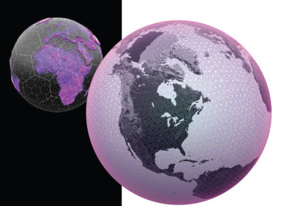
Bring It All Down to Earth with DGGS
Read moreHUMANITY’S ABILITY TO MEASURE, MONITOR, AND COMMUNICATE over the vastness of the entire Earth is unprecedented. Satellites swarm the Earth observing and measuring the events below. A web of sensors monitors and controls changes and movement of a billion…
- March 18, 2016
Data Management & Visualization: Married or Separated?
Read moreLarge users of geospatial data are searching for alternatives to Google Earth Enterprise (GEE), which Google will discontinue in the spring of 2017. Several geospatial companies offer partial replacements, though their offerings differ somewhat from each other and from...
- March 17, 2016
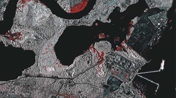
Discovering Invisible Data
Read moreREMOTE SENSING, AERIAL IMAGING, LIDAR and other technologies allow us to map almost every inch of the Earth with unprecedented precision. This approach supports in-depth geospatial analysis based on quantifiable data; however, there is great
value in adding qualitative information…