BY BRIAN GOLDIN / CEO/CO-FOUNDER / VOYAGER SEARCH
REDLANDS, CALIF. / www.voyagersearch.com
More than ever before, companies are developing solutions on Open Source technology, or they’re opening up their APIs for others to build upon in order to make their own software better. It’s often an easy, cost-effective way for organizations to broaden their capabilities, without reinventing the wheel—or bringing on more resources to expand upon said wheel.
Esri and Voyager Search have successfully taken advantage of Open Source technologies and open APIs to form a mutually beneficial, synergistic relationship. As the world leader in geographic
information system (GIS) solutions, Esri connects Fortune 500 companies, national and local governments, public utilities, and tech start-ups with maps, data, and apps through GIS.
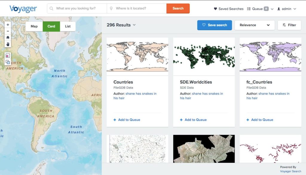
Voyager Search focuses on geospatial technology by providing the connective tissue between various GIS systems. Voyager Search builds a COTS enterprise search engine that makes GIS data and services discoverable and manageable across the enterprise.
The company leverages the power of Solr/Lucene to create a catalog of data stored in stovepipe systems so that they can be found from a single, unified search interface. Voyager can index some 1,800 different formats—map data, imagery, PDFs, databases, map services, Excel files, Word documents, videos—and seamlessly access those items regardless of whether they are stored in the cloud, a database, a content management system, a server, or on the file system.
PUTTING SYNERGY TO WORK
Esri’s Open Standards and open access to its APIs for their customers, coupled with Voyager’s ability to search for just about every type of content imaginable, enables our two companies to intersect seam- lessly in several ways, resulting in beneficial capabilities for customers who have both Voyager Search and Esri software.
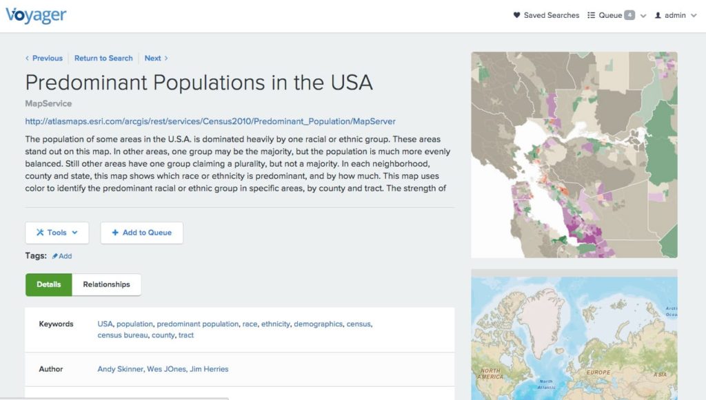
Voyager can index all of Esri’s content, which includes everything from vector data, raster imagery and LiDAR files, to the rows of shapefiles and Geodatabases, to web services and repositories of content like Esri’s ArcGIS Online and Portal for ArcGIS, two of its signature products. Basically, whatever way people store their content, Voyager can index it and show relationships between the parts. For example, in the case of an ArcMap document or ArcGIS Online map, each of which is composed of layers based on web services or other data, Voyager recognizes these inherent relationships (among maps, layers and data) during indexing, enabling Esri users to understand the composition of their work and to repurpose existing layer configurations to save time. Data managers are now able to understand which datasets are being used more frequently so they can ensure people are accessing the most up-to-date information at all times—all within a single point of search across all of their content.
For any organization, but especially those that are large or that lack tight controls for how they store data, it takes a long time to figure out what they have and how to access it. Many companies have different departments, or groups, and each has its own infrastructure. This means individual departments have different ways of sharing and storing data and services.
By installing Voyager in each location, Esri customers can index all of the content in that office, whether it is in another city, state, or international location. Each office will then have a local index of its content that a team can use to find, share and utilize its data, and Voyager can easily link the indexes together from all of the offices to deliver a single point of search across the entire company, regardless of where the content is stored.
EXPANDING THE INTEGRATION
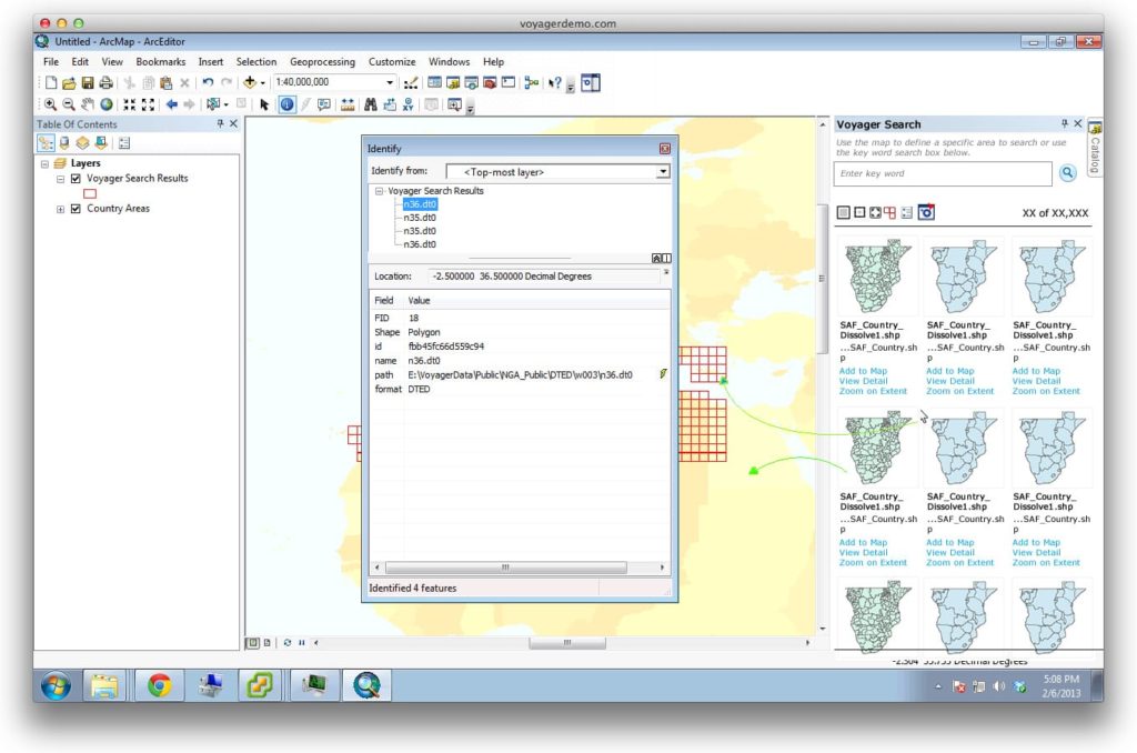
Over the past year, Voyager has done a lot of integration with Esri’s software, which includes everything from widening what we can index to supporting large distributed systems based on Esri deployments. One example includes adding a search feature inside Esri’s ArcMap product. This enables people to search for content that might be applicable to their project while working on a map within ArcMap. They can query the whole corporate catalog and see what they find right in the application—never having to leave it to search elsewhere. As soon as they find what they need, they can then click to learn more and then add it to their project. If by chance they change their minds, they just click on ‘remove,’ and it’s gone.
Another capability Voyager has created for Esri users is the ability to search within Esri’s
ArcGIS Online and Portal for ArcGIS. Within this Web mapping environment, Voyager’s integration is twofold; first, as organizations increase their adoption of ArcGIS Online and the on-premise version of Portal for ArcGIS, Voyager is able to link all of these instances together by use of Esri’s open APIs to index them into a single catalog, providing a single point of search. Second, Voyager has built on Esri’s APIs to deliver a search widget for querying any of its corporate data from directly within the ArcGIS Online or Portal for ArcGIS Web-based map. This provides the ability to freely search any and all data, not just what is stored within that particular instance of Portal ArcGIS or on ArcGIS Online.
Once an organization leverages Voyager to build a catalog of their data, they can use a traditional shopping cart experience to download and interact with their content. This is enhanced through integration with Esri’s geoprocessing environment. Further, through the use of Esri’s open APIs, customers are able to take Esri’s existing geoprocessing tools, as well as new ones that they create, and use them to run tasks on the content of their cart, such as data, Web services, files and even rows in database tables. Example tasks can range from converting from one format to another; clipping data to obtain a small, more manageable subset; mosaicing data together; and fixing or replacing broken data sources (often a frustrating and labor intensive process); to running analytical models on select search results. People spend a lot of time building models within Esri’s platform, but in order to run them, they need input data. Voyager allows them to find the content, add it to a list, and execute Esri’s processing task—streamlining the process of how they use Esri’s geoprocessing modeling tools and making them more accessible to the broader organization.
DRIVEN BY CUSTOMER DEMAND
With Open Standards and open APIs being such an integral part of how we do business, the interesting thing to note about Esri and Voyager Search’s working relationship is that there wasn’t a formal discussion between our two organizations in terms of who would build what. The driver to create these solutions was simply a matter of understanding customer needs and then mapping those needs to a synergistic use of each organization’s APIs. That’s the key to what makes this relationship work so well.
By putting the need to address specific user necessities as the focus of our working relationship, Voyager has helped Esri’s customers benefit from the investment they’ve made in Esri’s platform and assisted in their efforts to understand the breadth of all their content. This includes determining where they have duplicate data, finding ways in which they can improve efficiencies, and enabling employees to focus on their jobs, versus spending time looking for data.


