Mladen Stojic
President/ Hexagon Geospatial
www.hexagongeospatial.com
The Netherlands is a progressive country that embraces geospatial solutions in innovative ways. From digitizing massive volumes of historic imagery to embracing 3D data for monitoring the changing landscape, it is home to many forward thinking organizations that are bringing the power of spatial solutions to the forefront.
Key drivers for this are the requirements of local and national government agencies and private sector organizations, who are all continually striving to make sense of their dynamically changing world and respond in appropriate ways. With 20% of its area below sea level and 50% of its land lying less than a meter above sea level, the Dutch are used to needing cutting edge answers to challenging problems.
They know how to manage and understand a drastically changing landscape, all while ensuring sustainability.
Likewise, the Netherlands’ history is firmly tied to the wind. The Dutch are famous for using the wind to power many industrial purposes, and because of that, the windmill is firmly considered an iconic emblem of that country. Historically, wind has powered everything from grist mill operations to pumping water out of areas below sea level. Possibly more than any other nation, Holland has always understood the extensive power of harnessing this natural raw energy.
The wind is a catalyst for change—and demands a response. However, the wind is often uncontrolled, and can be confusing or even frustrating for citizens and local government organizations. In a similar vein, the massive influx of disorganized spatial data can be overwhelming for any organization. Raw data has tremendous potential to be useful, but must be controlled, organized, and synchronized to produce information.
Many organizations in the Netherlands are seeking the best tools and innovations available to best leverage volumes of geospatial data. Those organizations understand the reality that, while we live in a data-centric world, information must be interpreted and customized in order to be useful in driving effective decision making. This is the foundation for today’s geospatial solutions.
PROVIDING HISTORIC IMAGERY TO CITIZENS
The most forward-thinking companies understand that the only place to start is to organize data into one human-readable library. Dotka Data is one of them. A Netherlands-based services company, Dotka is creating a comprehensive, historic time-series library of maps and imagery covering over 200 years of Dutch history. The archive is formed by digitizing archives of aerial photographs and maps into digitally remastered and georeferenced databases for online distribution. To date, Dotka has digitized and exploited more than 60 Terabytes of geospatial data.
An impressive collection, the Dotka Data imagery archive includes topographic maps from as far back as 1798, and aerial photographs taken for topological purposes from 1932 to the present. Due to the age and breadth of the information in the collection, it offers a unique perspective on major changes and events in Dutch history. As an example, this data showcases the development of the Netherlands’ many polders (areas of reclaimed land), the location of unexploded shells from World War II, and the urban expansion of the 1970s.
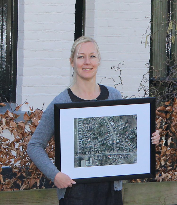
FIGURE 1.
One of Dotka’s early non-GIS customers poses here with a framed picture of her house and neighborhood. Initially focusing on the consumer market, Dotka became a popular site for accessing maps and historic imagery for areas of interest.
In taking this effort to the next level, Dotka Data has developed a new e-Commerce extension and online store. This interactive solution provides visitors a means for discovering and purchasing, on-demand, these massive collections of imagery and vector data-sets of the Netherlands.
The e-Commerce API that Dotka Data developed leverages ERDAS APOLLO technology, and includes three Webshop templates for accessing data as original photos, mosaics, geodata or PDF reports, all available for print or download.
According to Wouter Brokx, co-founder of Dotka Data, whether it is a sensor owner, data broker or a print media organization, the new API framework enables these organizations to quickly start exploiting large volumes of imagery and vector data in multiple Webshops simultaneously.
In addition, the e-Commerce API allows these organization’s customers to easily select, order, pay and receive geospatial information products made for on-demand use by content owners. This mechanism makes it possible for data owners to increase exposure of their content and ultimately drive revenue by adding new services into existing markets and new consumer markets.
The Webshop client templates essentially allow data vendors the ability to offer geospatial information to consumers and professionals with compulsory authorization. The Dotka platform currently supports the following shops:
Dotka Originals: These are original photographs in the form of framed camera scans that are available for download and print. Dotka Mosaic: These images are subsets cropped from georeferenced mosaics, and are available for both download and print as well. Dotka Report: This is automatic PDF creation and optional TIFF/SHAPE delivery of all selected layers including metadata, which is delivered within 15 minutes.In 2012, Algemeen Dagblad (AD), one of the largest Dutch newspapers, contacted Dotka early on to provide a free set of aerial photographs from 1960 and 2011. In six weeks, the organization served over 15.9 million previews, which is an incredibly high number considering the population for the Netherlands is only 16 million. The conversion rate of this effort was 15 percent of the AD readers, with an up-sell of 28 percent including a total of 189,000 high-resolution prints sold.
Powering all of this data organization and dissemination on the back end is ERDAS APOLLO. This enterprise-class data management, analysis, and delivery system enables any organization to catalog, search, discover, process, and securely disseminate massive volumes of file-based, database and web-enabled data.
Essentially, this solution allows any organization to manage and make sense of volumes of disparate data. Geospatial data that is distributed across multiple departments or offices can be easily organized and disseminated via a variety of different ways. ERDAS APOLLO also makes it easy for organizations to facilitate a central imagery repository while minimizing infrastructure and management overheads. The catalog is powerful enough to organize any data type in the enterprise, including business data, into one comprehensive, human-readable library.
CLEARING EXPLOSIVES USING SPATIAL DATA
The explosive legacy of the Second World War is a growing social problem across Europe. The Netherlands endured a tremendous amount of bombing during WWII and, while most of these munitions exploded, in many cases they did not. Over the decades since, many unexploded ordnance have unintentionally become buried in farm fields and even dangerously hidden under new construction in the hearts of big cities.
These older military ordnance become more sensitive to disturbance as they degrade over time, and pose a real risk of detonation. As recently as 2012, an unexploded WWII bomb was found under Schiphol, Holland’s busiest airport, requiring a large evacuation until the bomb was safely removed.
Dud explosives that failed to fire on contact are still unsafe and are often found through regular excavation and dredging. In fact, each year more than 3,000 explosives are discovered and cleared from the Dutch soil. With an ever-growing human footprint across Dutch lands, this is a potential danger that could cause tremendous harm to citizens.
To reduce the risk of human encounter with these unexploded bombs, Leemans Construction & Explosive Clearance conducts extensive research. Their core expertise is in properly locating explosives in the ground, even when the human eye can’t see them. Leemans has found a unique means of achieving discovery—historical photos used as the foundation for locating explosive devices, even for those that are hidden from the human eye.
Historical photos offer a clear picture of a time gone by. Through photo research, Leemans can unearth interesting information, for example where former buildings once stood. They can also determine the exact location of events or acts of war, which were previously unclear.
Most importantly, these images serve as the foundation for discovering new facts. Take, for example if a large bomber was hit during the war, an emergency landing may have also occurred. Prior to putting the aircraft on the ground, the onboard bombs would typically be discharged, which usually happened over water or uninhabited areas such as meadows. These types of bomb drops were not reported in the logs, but the bombs scar the land. Often, aerial photographs are the only witnesses of such occurrences and can reveal unique patterns in the soil. Before and after images of a raid show a world of difference.
To achieve this, Leemans Construction & Explosive Clearance makes use of solutions for performing advanced remote sensing analysis and spatial modeling. With this technology, they create new information and visualize results in 2D, 3D, movies, and on cartographic-quality map compositions. Ultimately, this advanced solution provides deep insights needed for combing areas for unexploded ordnances.
COMPREHENSIVE GIS, REMOTE SENSING AND PHOTOGRAMMETRY IN NIJMEGEN
Located near the German border, Nijmegen is considered to be the oldest city in the Netherlands and recently celebrated its 2000th year of existence in 2005. With nearly 166,000 inhabitants, the city also is home to 15,000 students from Radboud University, which gives this location a very unique and progressive character.
As such, the population is also very spatially aware, and the municipality embraces projects that combine GIS, remote sensing and photogrammetry tools to provide a breadth of analysis potential to apply to an ever-changing landscape.
Today, the Nijmegen municipality uses ERDAS IMAGINE and IMAGINE Photogrammetry, along with GeoMedia, to deliver relevant and accurate GIS information for multiple projects. The organization is forward thinking in its endeavors to integrate image and point cloud data archives for better overall analytics for environmental impact studies, habitat monitoring, green space monitoring, impervious surface mapping, urban planning, roadway management, and emergency planning.
While the municipality may engage in analytics that involve complex spatial modeling and analysis, the insights it provides must be easily consumable by someone who is not a GIS professional. The municipality is heavily focused on how it communicates the results of their powerful processes to citizens and organizations alike, all who utilize this information to make their own critical decisions.
MOVING FROM 2D TO 3D
It is common for many municipalities around the world to do their work completely in 2D. Nijmegen, however, is embracing 3D as a method for enhancing data delivery to citizens in a more dynamic way—resting on the belief that citizens want to fully connect what they are seeing on an application to what they truly experience in real life.
The municipality is currently leveraging Hexagon Geospatial’s platform of technology to develop innovative 3D change detection applications. It is in the process of creating a connected experience for its users, enabling them to stitch together different commands and models and visualize results in 3D.
It is clear that the Netherlands is a country that embraces the true value of geospatial—not only for enterprise operations, but also for enhancing services to its citizens. From leveraging historic imagery to providing a wide array of municipal-level solutions, there are many viable examples of the geospatially forward approaches the Netherlands takes on a regular basis.
Hexagon Geospatial will be showcasing a number of these stories at HxGN Live 2014. In the breakout session titled “E-Commerce for Massive Data to the Millions,” insights will be shared about the Dotka e-Business model. In the “Point Clouds for 3D and 4D Change Detection – From Building Assessment to Water Flow” breakout session, we will show attendees how making use of data-rich point clouds provides a huge benefit for organizations, from updating building footprints for base registrations and taxes, or to detecting changes in terrain for water flow control.
In the meantime, we recommend everyone keep their eye on this unique nation, as it will continue to remain on the forefront of innovation and use geospatial data in ways that truly transform how it operates and serves its citizens.