By Matteo Luccio/ Contributor
Pale Blue Dot LLC / Portland, Ore. / www.palebluedotllc.com
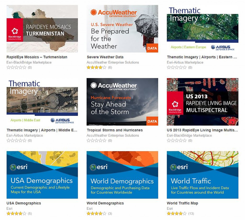
GIS users increasingly expect content to come with their platform, rather than be an add-on. To help meet this expectation, in September 2013 Esri launched ArcGIS Marketplace (https://marketplace.arcgis.com/). It allows ArcGIS Online subscribers to search for, browse, and download for use within their organization apps and data from Esri partners—such as DigitalGlobe, BlackBridge, Airbus Defence and Space, and AccuWeather—as well as apps created by Esri and its distributors and partners, such as Latitude Geographics, Azteca Systems, LizardTech, GISi, and con terra. All apps and data are built specifically to work with ArcGIS Online and can easily be shared with ArcGIS Online groups and users.
While anyone can browse the listings in ArcGIS Marketplace, only ArcGIS Online subscribers can get free trials or make purchases. They can then access their organization’s maps via the apps that they downloaded from the Marketplace and add to their basemap gallery or to other apps any data services that they acquired from it.
In addition, the Marketplace enables vendors of apps and data services to generate leads, provide free trials, grant access to listings, and manage subscriptions. All of the services in the Marketplace are subscription- based, but each is slightly different. The Marketplace serves as a gateway to services that are published by the vendors and are supplements to the ones that already come with ArcGIS Online. Some of them are offered by the vendors for free, as loss leaders.
“The valuable, authoritative content that users want to use is not only coming from Esri. It also has to be easy for us to make content available for users who are serving their own map services or map layers,” says Christophe Charpentier, Product Manager Lead ArcGIS Content, at ESRI. “For many years, Esri partners have been building applications or extensions to the ArcGIS system. The translation of that to the system into the cloud, including content services, was about empowering our partners to be able to make their content-based services available to our users. As users discover the content, they can find the added use services that interest them.”
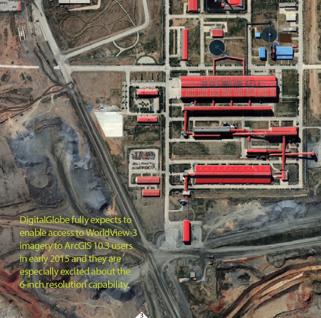
FIGURE 3.
This image from the new WorldView-3 satellite of a mine in China, captured on Aug. 23, 2014, is shown in 40-cm resolution, pending approval to release it at 30-cm resolution. Courtesy of DigitalGlobe.
Esri refers to the data and services on the ArcGIS Marketplace as Premium Content Services. To them, content can be imagery, it can be vector data, or other types of data. Premium content is content that users can purchase and use on top of what is already available in ArcGIS Online.
IMAGERY
Most of the ArcGIS Marketplace currently consists of imagery and imagery services. “We started with imagery vendors because we understand that there is a lot of value in imagery,” says Charpentier.
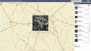
FIGURE 2.
Screenshot of the Satellite Tasking & Archive app, showing the app in action, with the AOI selected, and a list of tasking options displayed on the right hand side of the screen. Copyright: 2014 Esri. ArcGIS and ArcGIS Online are trademarks, service marks, or registered marks of Esri
in the United States, the European Community, or certain other jurisdictions. All rights reserved.
Perhaps the most basic imagery on the Marketplace is the DigitalGlobe Global Basemap, which consists of cashed imagery, including some aerial imagery, and is updated yearly. “We also have multispectral imagery from DigitalGlobe, Blackbridge, and Airbus,” says Charpentier. “By band combination you can actually extract information and analyze the imagery and use this as an information product rather than just a nice look- ing map. In the case of DigitalGlobe, you are getting access to the full eight bands of imagery here. So, through the image services, you can actually do the image exploitation and analysis that you would expect to do with those original pixels on your desktop. Here, however, you do not have to worry about hosting it yourself or serving it out; that’s already been taken care of by DigitalGlobe, yet you have all of the analytical capabilities at your fingertips.”
Some of the imagery is updated very frequently,such as DigitalGlobe’s First Look product, which focuses around events or disasters. It can be used for crisis response, planning, and disaster recovery, starting shortly after a disaster.
DigitalGlobe fully expects to enable access to WorldView-3 imagery to ArcGIS 10.3 users in early 2015 and they are especially excited about the 6-inch resolution capability. “We are excited to be entering this new remote-sensing era with Esri, one where the analytics are configured into the web service and where the user is not asked to think about whether a sensor had to be tasked in order to provision the content in the first place,” said Pierre Izard, Director, Alliance Sales with DigitalGlobe.
Blackbird has created color-balanced, virtually cloud-free, cached country-wide mosaics. Currently, they are available for 22 countries and are updated on a regular basis.
Airbus Defence and Space (Airbus DS) provides Thematic Imagery, which is a great basemap product. It consists of of 50-centimeter Pleiades data, which the company plans to update annually, as well as 1.5-meter SPOT 6 and SPOT 7 data, and radar imagery products from its TerraSAR-X satellite, which is refreshed every 11 days. Its Site Monitoring service combines imagery from all of these sources, and allows users to choose their preferred frequency. “If you want a daily revisit over your area, we may not be able to do it every day with TerraSAR-X, but we can do it with our constellation,” says Jessi Dick, Cloud Services & Online Partnerships Marketing Manager for Geo- Intelligence at Airbus DS.
DIRECTLY TASKING AIRBUS DS SATELLITES
One of the most interesting applications currently on the Marketplace is Airbus DS’ Satellite Tasking & Archive app, launched in July at the Esri International User Conference. It allows users to search the company’s archive of imagery from its SPOT and Pleiades satellites and, if they don’t find exactly what they need, to directly task a satellite to cover their area of interest.
“We’ve actually wired in, through the Airbus API, the ability to task the satellite live,” says Tony Mason, a Senior Consultant with Esri who has been lead- ing the effort to implement content vendors on the Marketplace. “There is no human interaction.” Users can then download the imagery through the application. “That application is published and operated by Airbus,” Charpentier explains. “Esri is just a facilitator through the connection with the user by exposing the application and by posting the end results of the imagery onto ArcGIS in the user’s private account.”
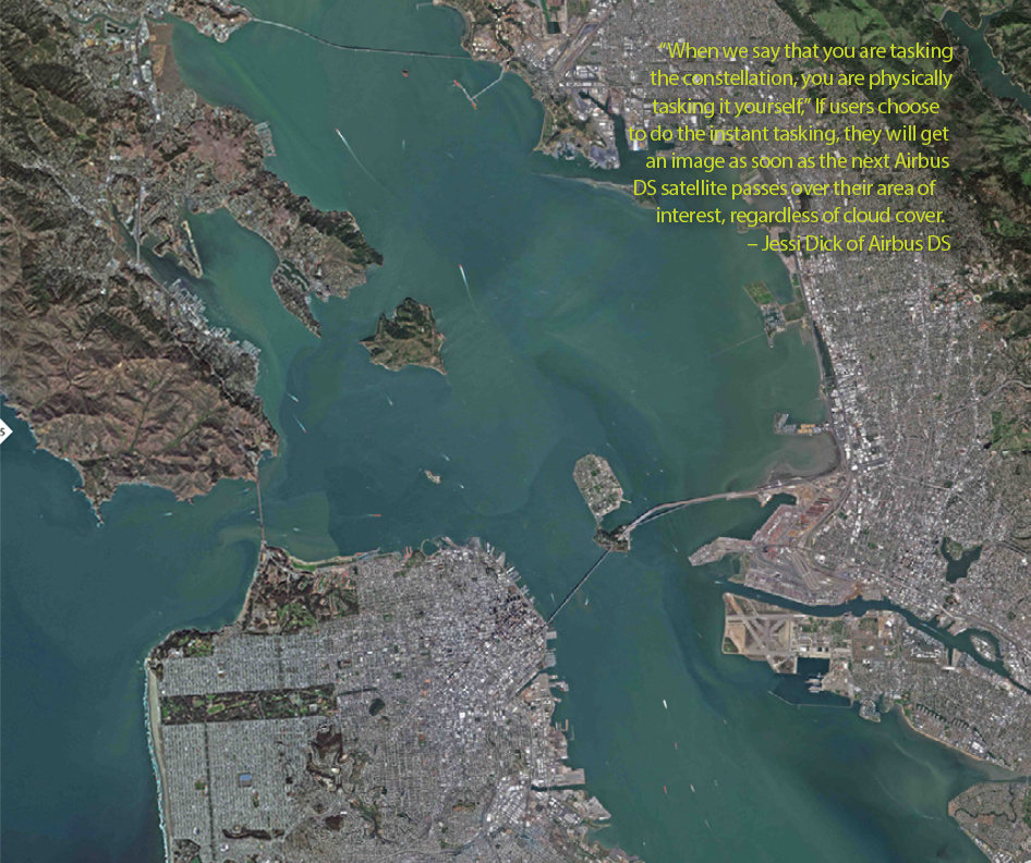
“When we say that you are tasking the constellation, you are physically tasking it yourself,” says Dick. If users choose to do the instant tasking, they will get an image as soon as the next Airbus DS satellite passes over their area of interest, regardless of cloud cover. “It is something that should be used only in emergency situations, or when you need something on a specific day,” says Dick. “For as little as $1620, you can task one of our satellites, and receive newly acquired imagery of your area within hours.”
Alternatively, they can choose the 30-day or the 60-day tasking options, in which they will receive the image as soon as a satellite gets one that fits their parameters. The 60-day option is a little cheaper than the 30-day option. “All instant tasking requests have maximum priority and will be shot, no matter what. These requests override anything else that has lower priority.” The 30-day tasking has lower priority and the 60-day has the lowest priority. “You will get it within 60 days, but usually much earlier.” Whichever options users choose, once they place the order in the application, it is added directly to the satellite’s plan, then acquired and delivered automatically, without any further human intervention.
In contrast, another Airbus DS service on the Marketplace, Site Monitoring, is managed by company staff, based on the user’s request to monitor particular areas or activities. “We put in the order to the satellite, we decide what makes sense, and send an analysis report to you,” says Dick. This service allows users to specify one or more sites that they want to monitor and their monitoring requirements. For example, a user who wanted to monitor the construction of soccer stadiums in preparation for the World Soccer Cup in Brazil would have been able to see the progression in their construction. Airbus DS delivers both the imagery and information on the changes from one image to the next, overlaid on a Webmap. “We deliver it to you in a nice Esri Story Map format, complete with both imagery and analysis,” says Dick.
A third Airbus DS service on the Marketplace, called Thematic Imagery service, provides different themes, which it updates on a regular basis. The first one they have launched is airports of Eastern Europe and the Middle East. “As time goes on, they’ll add other themes, such as ports and railroads,” says Mason.
BLACKBRIDGE PRODUCTS
BlackBridge offers three services based on orthorectified RapidEye imagery: RapidEye Mosaics, Living Image Basemap, and Living Image Multispectral. “RapidEye Mosaics are seamless, cloud-free, static collections of the best available imagery over a country,” says Scott Soenen, the company’s Chief Technology Officer. “They provide an up-to-date, high-quality image basemap for GIS projects. The Living Image Basemap is a dynamic, natural-colour mosaic of RapidEye imagery over a user’s area of interest that is updated quarterly with the best available imagery. The Living Image Multispectral is also a dynamic mosaic, but is avail- able with the full 5-band multispectral data, including the red-edge band. Clients can choose their area of interest and frequency of updates: quarterly, semi-annually, or annually. BlackBridge then selects the best-available imagery from our collection to populate the services.”
The Living Image services are only available through the ArcGIS Marketplace. “ArcGIS enables true dynamic delivery of imagery through Web services,” Soenen explains, “which means that imagery is updated and delivered to customers with very little effort required on their part. When customers load the service in ArcGIS, they will always be using the highest quality, most current RapidEye imagery.”
CUSTOMIZED FOR ARCGIS
Some of the providers are customizing their imagery to work best in ArcGIS. For example, Mason points out, DigitalGlobe’s multispectral service is a completely customizable service. “We are going to deliver this data at one of the rawest possible levels of imagery, then we are going to work with the customer to customize it. They are not just delivering plain old DigitalGlobe imagery. They are working with the customer to understand what their use case is going to be. So, if I am doing coastal or hydrology analysis, I may need some different algorithms tied to this particular service.”
Blackbridge’s imagery is orthorectified to a very high positional accuracy standard so that the imagery aligns with the users’ data, according to Soenen. “We try to ensure that all imagery is orthorectified with less than 10-meters RMSE (root-mean-square- error) positional error. Recent testing shows that we average 6-meters RMSE.”
BUSINESS MODEL
Most of these services are available only through the ArcGIS Marketplace. “This data is like a dial tone into ArcGIS Online,” says Mason, “meaning that ArcGIS Online is where our users come in to share and find their data. So, these are exclusive services to ArcGIS Online and the ArcGIS platform.” However, the content is not necessarily exclusive to the Marketplace. “We are not prohibiting them from selling their content to other customers in other sales channels or with other delivery methodologies,” says Mason. “We are taking a service from them and making it available in ArcGIS Online.”
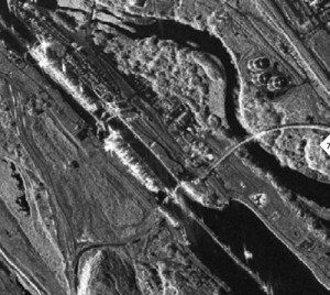
FIGURE 7.
Panama Canal 50-cm image, collected Dec. 12, 2013, from radar satellite TerraSAR-X. Copyright
DLR e.V. 2013, Distribution Airbus DS/ Infoterra GmbH.
None of the imagery available through the Marketplace is stored on Esri servers. “Unlike traditional imagery delivery mechanisms, where pixels and 7 individual files get moved around, the individual images and files stay with the partner and, instead, they just register a Web service—in this case, an image service— inside of the Marketplace for the customers to access,” says Mason. “We are moving away from the model of our users having to buy and store the pixels themselves. Instead, they are renting access to the imagery through the ArcGIS Online platform and the Marketplace.”
“For many, many years,” says Charpentier, “if you wanted to get access to multispectral imagery, you had to get it physically delivered to you and it was a huge challenge. So, imagery vendors and Esri were getting along very, very well but each of us was delivering our own capacity to the end user and the end users were implementing them on their own systems. This is offering us, mutually, the capacity to offer to end users a much better user experience. Now we are offering users the capacity to get access to the power of multispectral imagery through their standard ArcGIS experience, without having to deal with the logistics of where the imagery is, how to implement it, and how to set it up. That is where it really reinforces Esri and the imagery vendors: they are offering a much better user experience to the end users.”
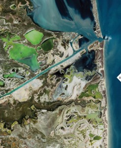
FIGURE 8.
SPOT 7 1.5-m pansharpened image of Port Isabel, Texas, taken July 3, 2014, copyright and courtesy of Airbus DS/Spot Image 2014.
Airbus DS’ satellite tasking application automatically charges the users’ subscription accounts every time they buy imagery, whether from the archive or from direct tasking of the satellites. Its site monitoring and thematic layers are also subscription services. On the ArcGIS Marketplace, the company provides imagery from all of its sensors, but it does not currently offer any of its 3D products, image processing services, global seeps database, geological studies, or some of market-specific monitoring services. However, some of those may become available later on, according to Dick.
While Airbus DS sells its imagery products to anybody through a variety of channels, its Thematic Imagery layers optimized for ArcGIS and its Satellite Tasking application are available only through the Marketplace. “Site Monitoring is something we also do elsewhere,” says Dick, “but it is only through the Marketplace that you get it delivered in a nice, Story Map format that allows you to quickly go through the reports day by day in one screen.” Airbus DS has also sold to Esri its SPOTMaps 2.5 global mosaic product and some Pleiades imagery over cities across the world, so that Esri could include them in its world imagery basemap, which is available for no extra fee to all ArcGIS Online users.
With its imagery and services on the Marketplace, Airbus DS is not targeting its current users, according to Dick, but potential new ones, “the Esri users to whom we have not previously had access, or who maybe have not used our imagery in a while.”
BlackBridge became an Esri business partner three years ago. “Many of our customers view or process RapidEye imagery with ArcGIS, so we were interested in how we could enhance that experience for them by partnering with Esri,” says Soenen. “The ArcGIS Marketplace has allowed us to tailor new BlackBridge products specifically for the Esri community and makes it easy for Esri users to discover relevant RapidEye imagery.”
BlackBridge offers three services based on orthorectified RapidEye imagery: RapidEye Mosaics, Living Image Basemap, and Living Image Multispectral.
“We’ve had a partnership with Esri for more than 20 years,” says Dick. “The advent of their Marketplace gave us an outlet to reach out and help serve their customers better. We and Esri worked very closely together, over several months, to get those done, so we definitely strengthened our partnership and continue to do so.” Izard notes, “DigitalGlobe and Esri continue to collaborate actively to streamline accessibility of imagery and imagery-derived information for the WebGIS user. Esri’s work on the ArcGIS Marketplace but also on imagery processing technologies overall are truly helping the raster and vector cultures converge. This is a significant dynamic for the geospatial industry.”
The ArcGIS Marketplace offers clear benefits to Esri’s users, who get direct access to a wealth of imagery and imagery services, and to its partners, who get direct access to Esri’s huge user base. Additionally, some of the services provided through the Marketplace, such as BlackBridge’s extensive archive of multispectral RapidEye imagery over very large areas, would not be sustainable without access to this large market.

