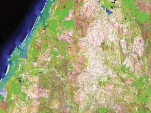
Above Featured Image: The Parana River follows the border of Paraguay (to the north) and Argentina in South America. The Lagunas y Esteros del Ibera? wetlands lie to the south of the river and cover more than 7,456 square miles (about 12,000 square kilometers) in the Argentine province of Corrientes. The wetlands consist of marshes, swamps, and lagoons, of which nearly 60 percent are permanently inundated, and have remained largely untouched by human activity. This image was taken with the L5 TM sensor on Jan. 21, 1992. Lat/Long is -27.511/-56.849. Image courtesy of U.S. Geological Survey, Earth Resources Observation and Science Center.

Myrna James Yoo
Publisher: Apogeo Spatial (formerly Imaging Notes)
and LBx Journal
Owner: Blueline Publishing LLC
DEAR COLLEAGUES,
Finally, after years of discussion and requests, with the official endorsement of the U.S. Intelligence Community announced at the GEOINT Symposium in April, the changing of DigitalGlobe’s commercial remote sensing license with NOAA seems inevitable. While not yet approved by The White House, this change would certainly benefit DigitalGlobe by allowing them to participate in the global marketplace by selling data with 25-cm resolution (vs. the current limit of 50-cm), primarily competing with Airbus Defence and Space and with the aerial photography companies.
As we continue covering The Age of Disruption and how companies are changing the economics of Earth observation, this issue features interviews with two smallsat companies, BlackBridge and Skybox. BlackBridge purchased the five-smallsat constellation of RapidEye in 2011, and has now completed the transition to include delivery on a cloud-based system with focus on multi-temporal change detection applications and broad-area mapping. This interview with CTO Scott Soenen and Sensors & Systems (our Location Media Alliance partner) in this article.
Skybox launched their first smallsat with the first commercial high-res video from space, plus electro-optical imaging, in November 2013. The company was founded by four students at Stanford University who met in a graduate-level class in 2008, where they wrote the first business plan for Skybox. Their story began there, and our story begins in this .
Interviews with both Planet Labs and PlanetiQ are coming up in our Summer issue.
“Calm technology” is a passion of Esri’s Amber Case, interviewed by Natasha Léger of LMA partner LBx Journal on page 40. Location data is at the heart of the connected world. Everything is connected. Calm technology offers ways for this to be more manageable for us, as humans.
We are privileged to publish a summary of Euroconsult’s first ever report on Earth Observation Data Distribution by Adam Keith, Director of Space and Earth Observation. Summarized are distribution mechanisms, such as partnering and forming alliances; geographic distribution of distributors; and factors influencing sales. The summary begins in this article. The full report is available for purchase on the Euroconsult website: here.
Airbus Defence and Space officially launched at the GEOINT Symposium the much-anticipated WorldDEM Digital Elevation Models of the entire Earth, after years of collecting radar data with twin satellites TerraSAR-X and TanDEM-X. We covered this in our Fall 2013 issue, which can be found here.
Hexagon has launched a new division, Hexagon Geospatial, after several acquisitions
of companies. Read about how The Netherlands, a country with unique geographic needs including much reclaimed land (polders), is using geospatial data, such as Nijmegen municipality, which is using geospatial tools and data for several projects, including moving from 2D to 3D for change detection. Many users of the data are non-GIS experts.
Working towards solving global problems is the Group on Earth Observations (GEO), to which the Secure World Foundation was elected as a Participating Organization, announced at the January 2014 GEO Ministerial Week in Geneva. Secure World Foundation held a workshop, “Disasters Risk Reduction and Earth Observations: A GEOSS (Global Earth Observation System of Systems) Perspective,” which brought together 15 speakers from around the world to share on advancing GEO goals, such as data sharing, user engagement, and space applications in service to humanity. More information can be found here, in the Secure World Foundation Forum.
The importance of the worldview that these companies and organizations provide is revealed in these words from Socrates:
“Humanity must rise above the earth, to the top of the atmosphere and beyond. For only then will we understand the world in which we live.”