-
November 17, 2019
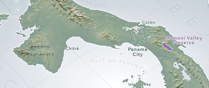
PanaMapping: GIS for Conservation Science
PanaMapping is about how geographic information system (GIS) technology supports conservation goals in Panama by revealing how physical features…
0 -
July 29, 2019

The Intersection of Tech, Data & Music and the Iconic Year 1969
Paul D. Miller, aka DJ Spooky, is a composer, multimedia artist, and writer whose work immerses audiences in a…
-
July 26, 2019

-
July 26, 2019

The Power and Awe of Seeing Earth from Space
“If somebody had said before the flight, ‘Are you going to get carried away looking at the earth from…
-
February 12, 2019

Lidar from Space!
Since the International Space Station (ISS) began operations in November 2000, it has served as a host platform for…
-
August 22, 2018

Food Production Monitoring and Urban Transportation
TellusLabs, co-founded by Drs. David Potere and Mark Friedl in 2016, builds systems for environmental intelligence, mostly using satellite…
-
August 18, 2018

Making Space Simple
Executive Interview
With Alex Greenberg, Co-founder & Head of Operations, Loft Orbital
Loft Orbital has introduced a unique business model that…
-
August 17, 2018
Perspectives on Satellite SAR Remote Sensing
The 10th anniversary of satellite-based commercial SAR (synthetic aperture radar) was just last year in 2017. This still-young discipline…
-
May 16, 2018
NakedEarth
Novlum Inc. has created the first and only global bare earth elevation model, called “NakedEarth”. NakedEarth is a 30-meter…
-
May 16, 2018

Meaningful Mapping
When it comes to determining what a particular object is, nothing beats a personal inspection. With a ground survey,…